OkMap 17.6.0
- Categoría: Geo Tracking
- Licencia: Freeware
- Tamaño: 405.27 KB
- Sistema: w2000 wXP Vista w7 w8
- Idiomas:


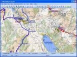
It shows you the way via vectoral maps.
OkMap is a free program that helps you in various activities outside, like for example trekking, hunting, fishing, etc.
OkMap helps you calibrate vectoral maps with different types of cartographic projections, create digital maps, show pastorized maps and vectored data simultaneously, create and represent entry and exit points on maps, routes (which can be saved in GPX format), navegate in real time via a GPS device using an NMEA protocol, show maps from Google Herat and Google Maps in a set plan, use a calculator, make conversions between coordinates and data, etc.
OkMap supports the following formats: ecw, bmp, gif, jpg, png, tif and many more (for images), gfw, jgw, pgw, tfw, bpw (for maps), shp and dbf (for vectoral data), Gpx (for GPS data), etc.
An essential program so you don´t get lost.
DownloadOkMap 17.6.0 related downloads


Garmin Mapsource 6.16.3
 Download
Update for GPS programs like Garmin or Mapsource that generates new and better maps.